It’s late December. Along the Line of Actual Control (LAC), the mercury plunges to minus 15 degrees Celsius in the afternoon. Mindful of the India-China peace agreement, troops equipped with latest technology are constantly patrolling the area in snow.
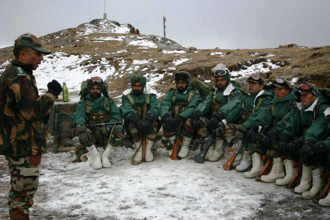
A young Major from the 14 Punjab regiment briefs the troops. “Keep in mind the Border Defence Cooperation Agreement (BDCA). Look for telltale signs (Chinese activity). Take pictures and document them,” Brigadier DS Kushwah tells the well-clad group. The BDCA, inked in 2013, has helped lower tensions along the border. “Meetings have helped. BDCA-type agreements do help in resolving local issues,” he said.
“We are also trying to absorb more and more technology solutions. Latest technology such as sensors, night-vision cameras and Long-Range Reconnaissance and Observation System (LORROS) allows greater response time to Indian troops,” Brigadier Kushwah said.
The McMohan Line drawn up by British Foreign Secretary Henry McMohan in 1914 — disputed by China — is the cause for differing perceptions along the tense LAC, the 3,488-km de facto Sino-Indian boundary that runs east-west along the Himalayan ridgeline. New Delhi and Beijing have claims and counter-claims, yet they have to ensure against gun-toting soldiers on either side literally pulling the trigger.
The LAC near the Bum La, 16,000 feet above sea level, is a 37-km distance on a dirt-track north of Tawang, home to the famous Tibetan monastery. It was from this spot that China’s People’s Liberation Army (PLA) entered India in October 1962 and rumbled down for almost 300 km or till the lower hills of Arunachal, close to the plains of upper Assam.
As a team of The Tribune reaches the top of 14,400 ft-high hill amid heavy snow, the patrol party is “watched” from the base, where others enjoy a hot meal of “kadhi-chawal” (gram-flour curry and rice).
“A patrol party can sustain on its own for 72 hours. The situation will worsen when temperature will drop to minus 30 degrees Celsius in January,” said Colonel Rajesh Singh, Commanding Officer of the 14 Punjab (Nabha Akal) Regiment who hails from Palampur in Himachal Pradesh. Training for the infantry includes Wushu (unarmed combat), rock climbing, launching mortars, firing from rifles in the snow, running for a specified length to doing snow patrols. Besides military training, some of the troops have learnt Chinese. In his book “India’s China war”, Neville Maxwell explains the differing perception of the LAC and takes it back to the 1914 Simla conference between British India, China and Tibet (which was then an independent entity).
“McMohan was filing out details on the maps up to the last moment…the line was drawn on two map sheets at a scale of eight inches to a mile….it was accepted by Tibet in March 1914 through an exchange of letters which made no mention of any principle (watershed or ridgeline) upon which the line was drawn,” the book reads.