Rajat
Prime VIP
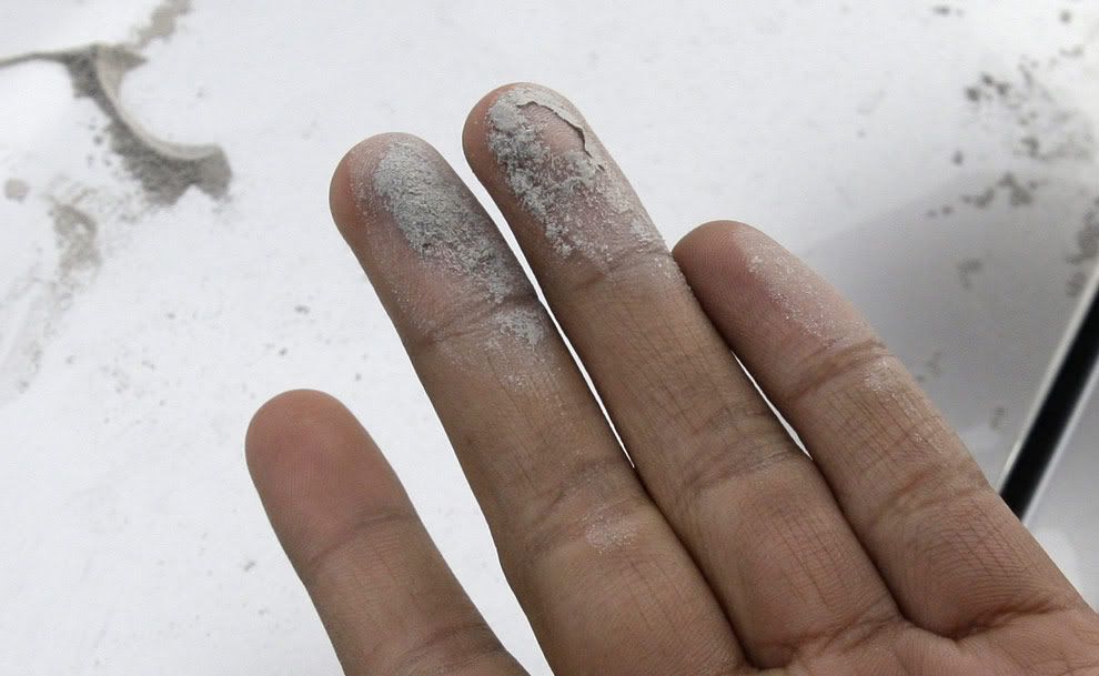
Beginning March 22nd, 2009, Alaska's Mount Redoubt, began a series of volcanic eruptions, and continues to be active to this date. Ash clouds produced by Redoubt have pushed 65,000 feet into the sky, disrupting air traffic, drifting across Cook Inlet, and depositing layers of gritty ash on populated areas of the Kenai Peninsula and Anchorage, about 180 km (110 miles) to the northeast. Mount Redoubt has erupted at least five times since 1900, with the most recent event taking place in 1989.
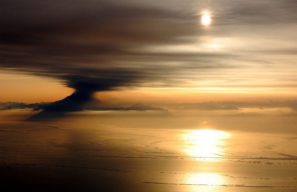
An eruption of Mt. Redoubt seen at sunset from the cockpit of a DC-6 flying over Cook Inlet near Anchorage, Alaska on March 31, 2009. Photograph kindly provided by Bryan Mulder - pilot and photographer.
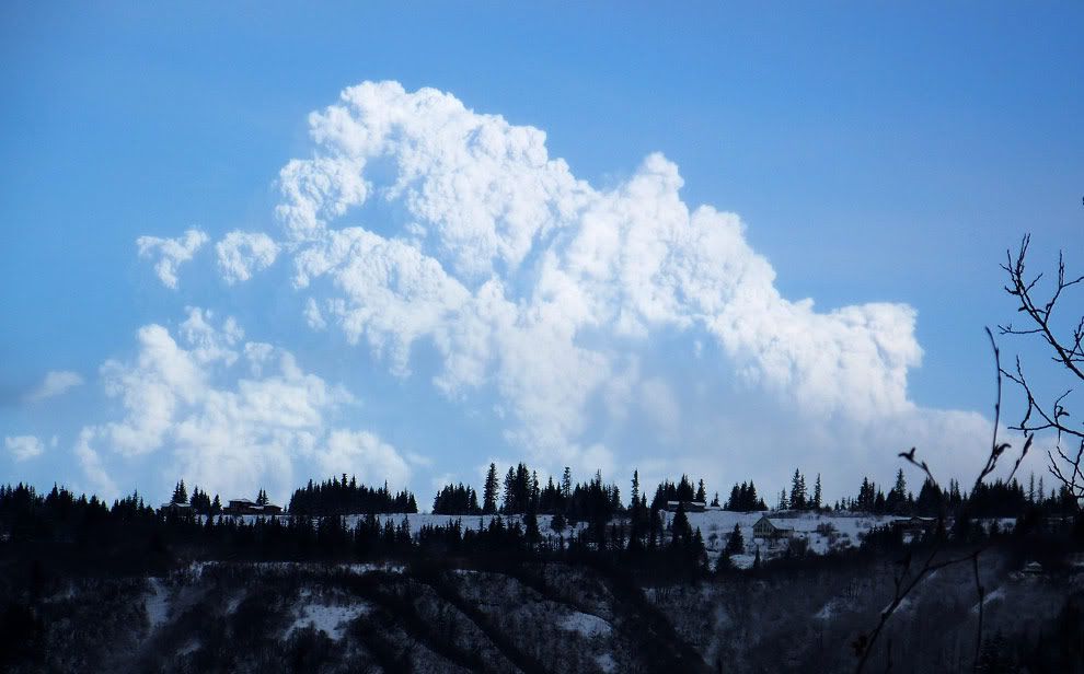
An ash cloud from the eruption of Redoubt volcano rises above the horizon in Homer, Alaska, Thursday, March 26, 2009. The eruption Thursday morning sent an ash cloud 65,000 feet above sea level, the Alaska Volcano Observatory reported.

Photograph of Redoubt's March 27th eruption cloud, as seen from near Homer, Alaska.

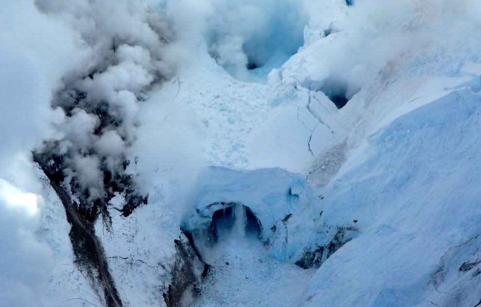
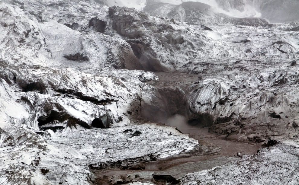
Crater on Mt. Redoubt showing rapidly melting glacier and enlarged "ice piston" feature (a crater-like feature made of ice, but with vertical walls, formed by a plug of ice dropping down vertically as ice at the base melts and the water flows away).
A hole beneath the dome formed in an earlier eruption event in 1990. Picture Date: March 21, 2009

Closeup of the top vent in the Redoubt summit crater, seen on March 21, 2009

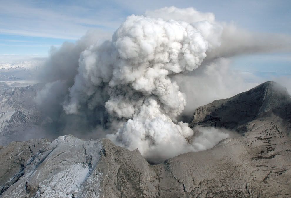
Panorama of a plume trailing off to the northeast from Mt. Redoubt on March 31, 2009. The plume contains fine ash which is creating a haze layer downwind of the volcano, and peppering snow-covered mountainsides.

This satellite image provided by GeoEye and taken Monday March 30, 2009 shows Alaska's Mount Redoubt volcano as it emits a steady ash plume. A light dusting of ash fell for the first time on Anchorage on Saturday.
View to the east of the summit crater of Redoubt volcano, heavily covered with deposits from recent eruptions. The near ridge, right of the notch, is the upper reach of the Crescent Glacier on the southwest flank. Picture Date: March 31, 2009.

An eruption of Mt. Redoubt seen at sunset from the cockpit of a DC-6 flying over Cook Inlet near Anchorage, Alaska on March 31, 2009. Photograph kindly provided by Bryan Mulder - pilot and photographer.
An ash cloud from the eruption of Redoubt volcano rises above the horizon in Homer, Alaska, Thursday, March 26, 2009. The eruption Thursday morning sent an ash cloud 65,000 feet above sea level, the Alaska Volcano Observatory reported.
Photograph of Redoubt's March 27th eruption cloud, as seen from near Homer, Alaska.
Crater on Mt. Redoubt showing rapidly melting glacier and enlarged "ice piston" feature (a crater-like feature made of ice, but with vertical walls, formed by a plug of ice dropping down vertically as ice at the base melts and the water flows away).
A hole beneath the dome formed in an earlier eruption event in 1990. Picture Date: March 21, 2009
Closeup of the top vent in the Redoubt summit crater, seen on March 21, 2009
Panorama of a plume trailing off to the northeast from Mt. Redoubt on March 31, 2009. The plume contains fine ash which is creating a haze layer downwind of the volcano, and peppering snow-covered mountainsides.
This satellite image provided by GeoEye and taken Monday March 30, 2009 shows Alaska's Mount Redoubt volcano as it emits a steady ash plume. A light dusting of ash fell for the first time on Anchorage on Saturday.
View to the east of the summit crater of Redoubt volcano, heavily covered with deposits from recent eruptions. The near ridge, right of the notch, is the upper reach of the Crescent Glacier on the southwest flank. Picture Date: March 31, 2009.
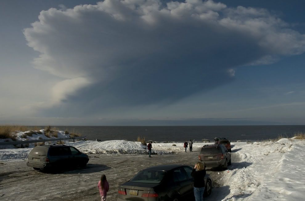
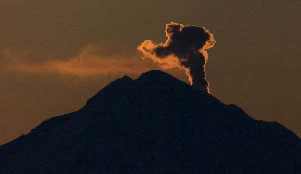
An eruption of Mt Redoubt, seen from a distance on March 28, 2009.


")